Menu

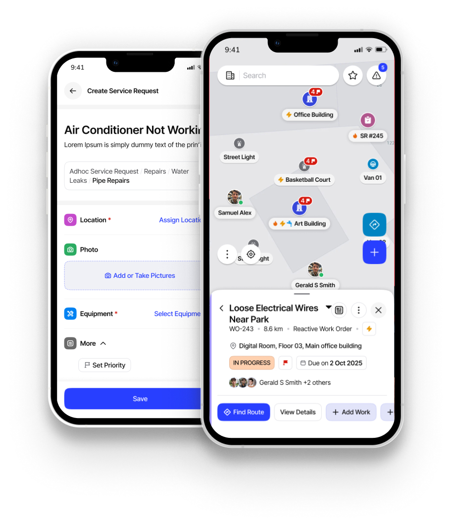
Mobile
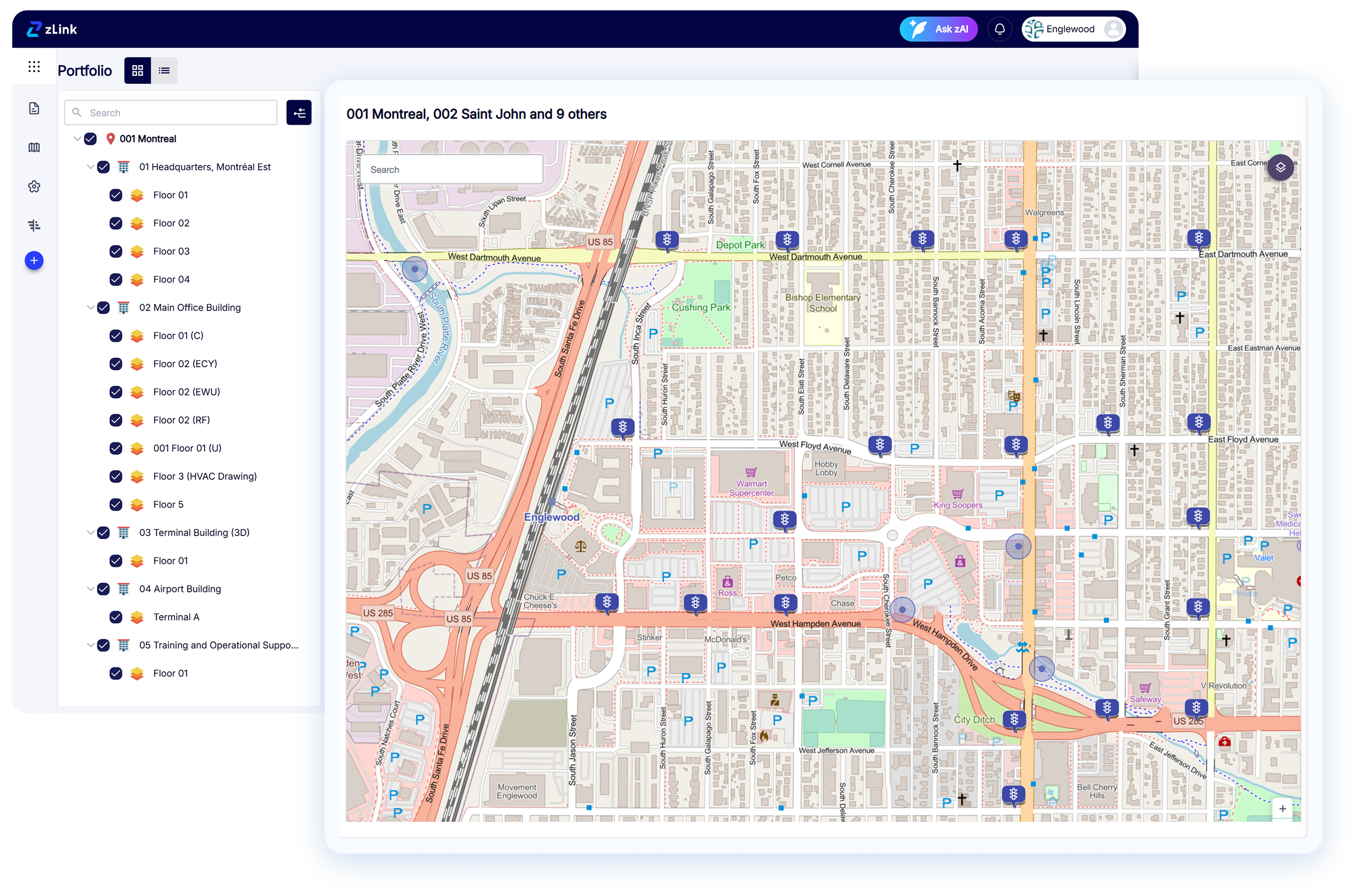
zLink’s GIS Mapping works across browsers, tablets, and mobile devices, empowering teams in the field.
>2x
zLink more than doubled asset data coverage — from the low 40%s to the high 80%s.

Read case study

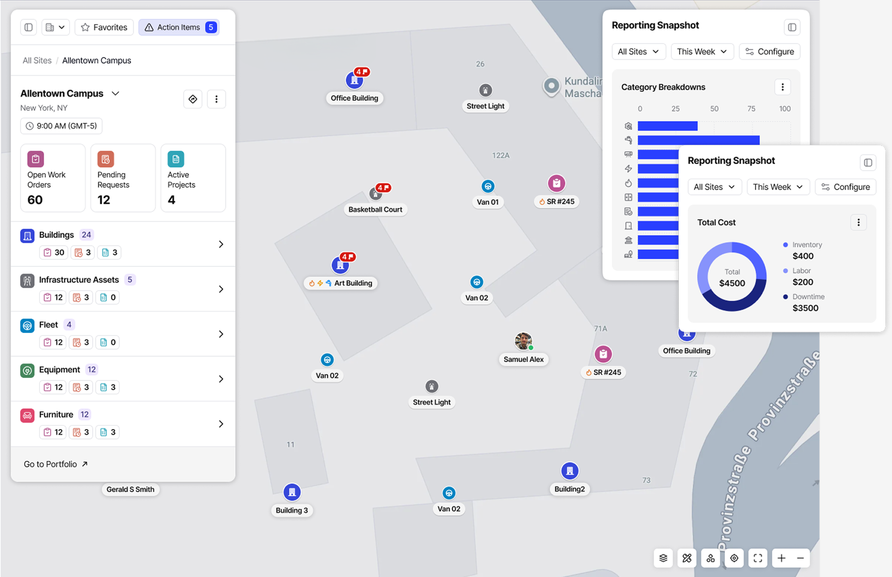
Live Status Updates
Get real-time visibility into asset and facility performance
zLink enables teams to monitor high-priority issues, equipment downtime, and active work orders directly on a GIS map — ensuring faster awareness and a coordinated response.
>2x
zLink more than doubled asset data coverage — from the low 40%s to the high 80%s.